
For a better understanding of how urban agriculture practiced in community and backyard gardens can function to help address the issue of food access in low-income neighborhoods we aim to address the following three research questions:
- In what different ways do community and backyard gardens in Tucson serve low-income populations in terms of food access and security?
- What types of challenges exist when initiating a new community or backyard garden in terms of serving low-income populations?
- How can the environmental sustainability of these types of urban food production be enhanced?
In order to comprehensively answer each of the three questions, the project has emphasized an applied research approach that engages both the community partner organizations and their gardeners. To facilitate this process, data collection methods have relied on spatial and qualitative techniques to incorporate the ideas and opinions of the project’s community partners.
To capture, analyze and present spatial data on urban gardening in Tucson, the project utilizes the technological application of a geographic information system (GIS). The use of GIS and spatial analysis within the scope of the project has been essential in identifying low-income, food desert regions as well as migrant populations. Following the mapping of Tucson’s socioeconomic profile, community gardens selected for this study are located in neighborhoods vulnerable to the risk of food insecurity. The maps generated during the initial phase of the project are presented as follows:
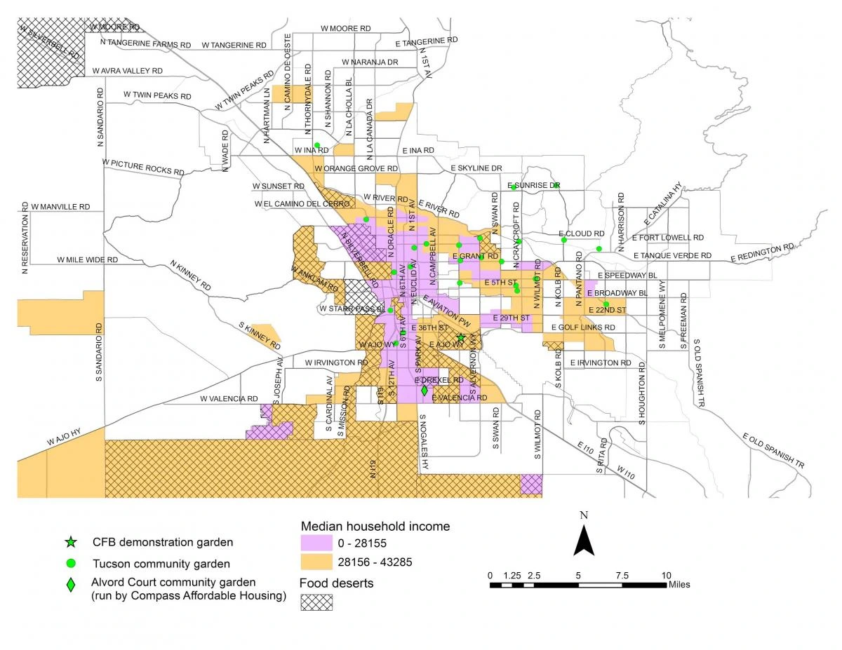
Distribution of household median income and food deserts across the city of Tucson, Arizona. Also identified are community garden locations for the nonprofit organizations of Compass Affordable Housing, the Community Food Bank of Southern Arizona, and the Community Gardens of Tucson. Map created by Daoqin Tong.
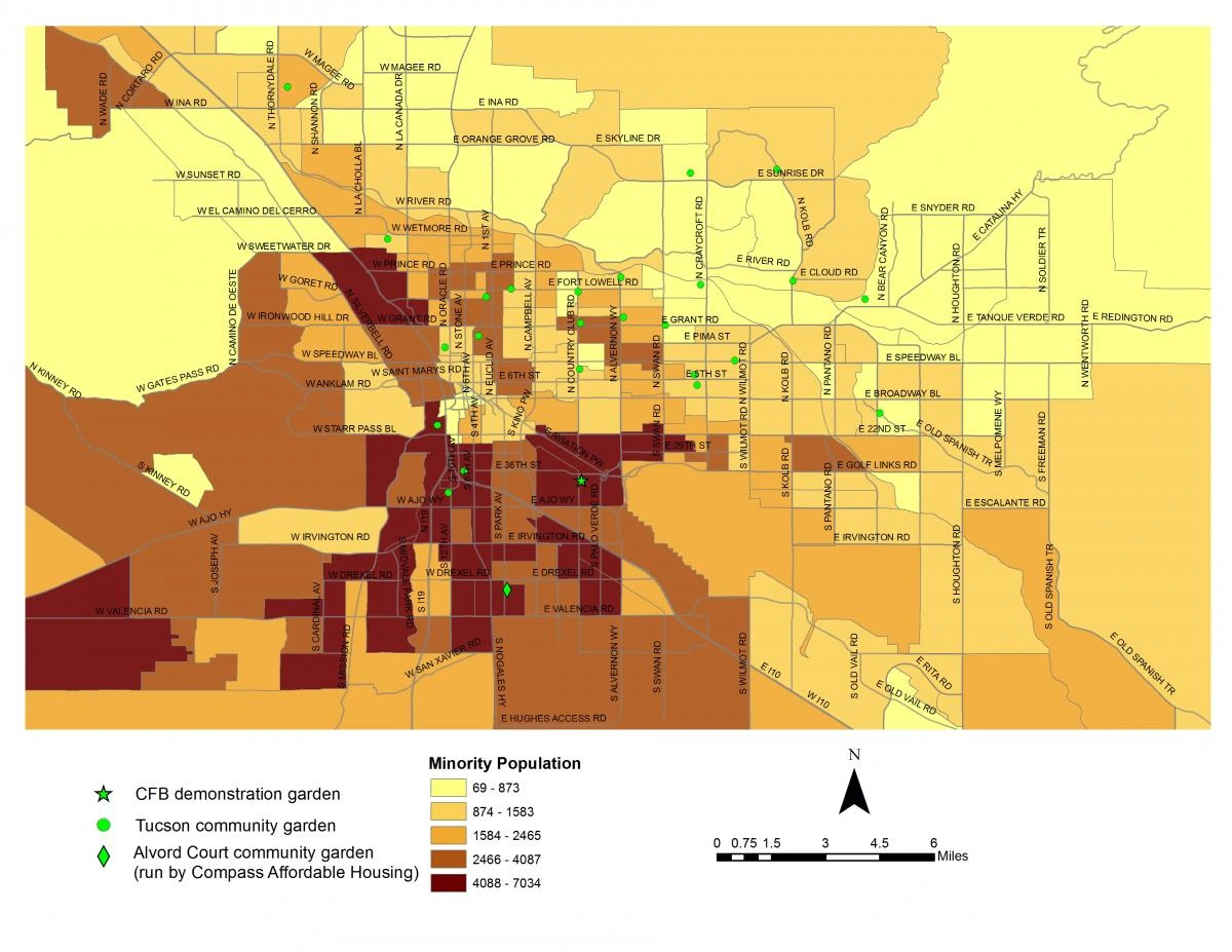
Distribution of minority populations across the city of Tucson, Arizona. Map created by Daoqin Tong.
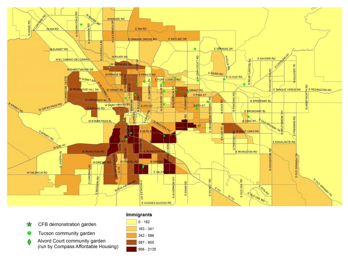
Distribution of migrant populations across the city of Tucson, Arizona. Map created by Daoqin Tong.
Qualitative methodology has also served as an integral component within the project through the use of surveys, individual and focus group interviews. Utilizing a combination of these methods has allowed for an expansive and in-depth recording of the needs and experiences of low-income community and backyard gardeners. To analyze the data collected, GIS and statistical analyses will be used to test hypotheses concerning gardening practices and various socioeconomic factors. Subsequently, results from the project will be shared with the project’s community partners to determine what resources are vital to the sustainability of urban agriculture within low-income, food desert regions in Tucson.